Guidebook with maps/step-by-step
1- From the car park, opposite the viewpoint, you will see the signpost for the trail that leads to the first fountain.
2- From there, follow the path up towards the road. At the crossroads after the picnic area, continue straight ahead on the dirt track that will take you to the Bourrastel fountain.
3- From this fountain, retrace your steps slightly, then take the path that will lead you to Les Séniès.
4- Cross the hamlet, turn right after the houses, then descend to the intersection. There, turn left until you reach La Grand'Borde.
5- At the ‘de la croix de pierre’ crossroads, turn left (you will then retrace your steps) to admire the Coumels fountain, hidden in the woods.
6- Continue along the road until you reach the Grand'Borde fountain.
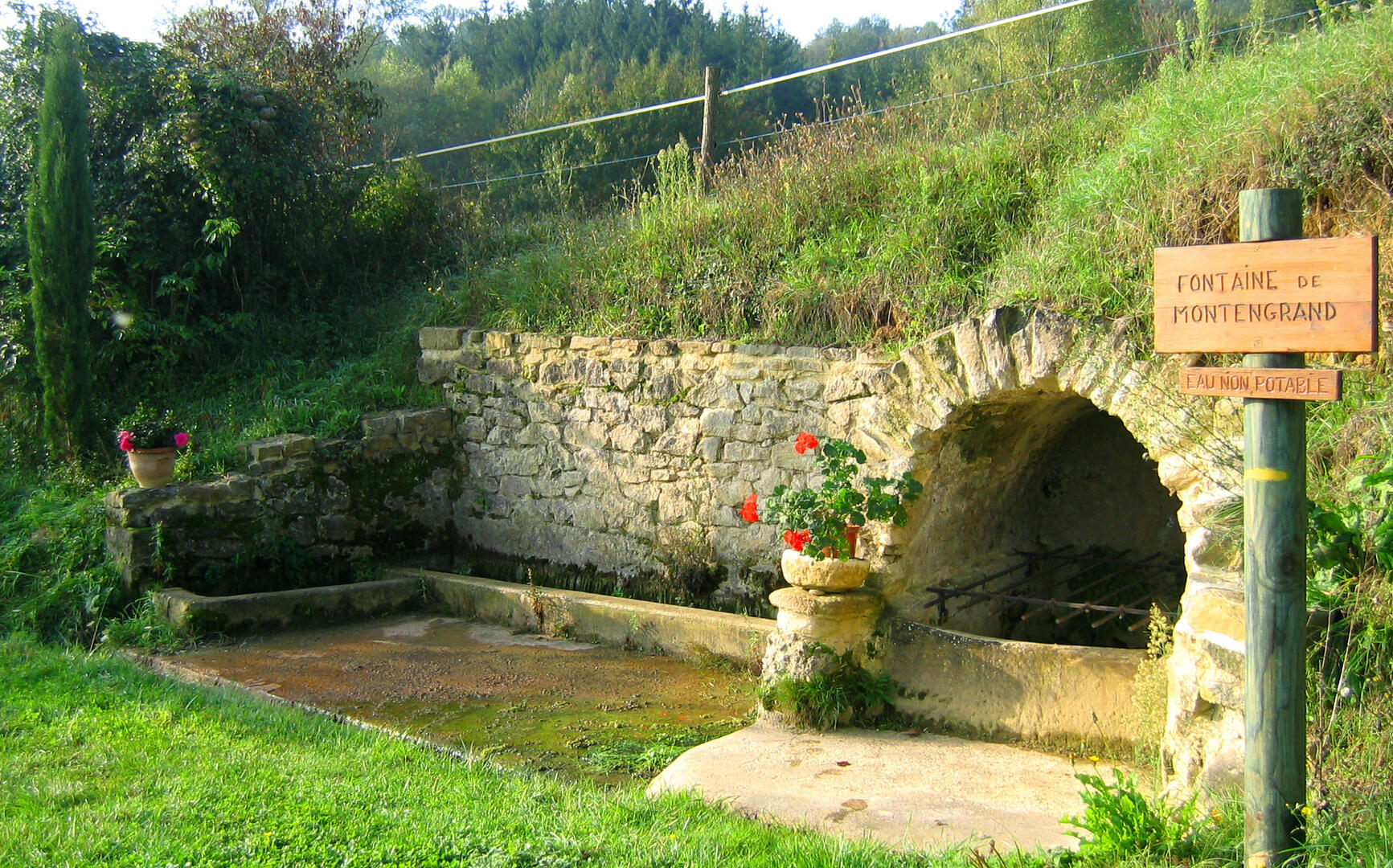
7- After the Grand'Borde fountain, take the old railway line on the right for about 1 km, before turning right at the second bridge. Follow the grassy path to find the road leading to the hamlet of Montengrand. 50 metres after leaving the hamlet, take the path on the right that passes in front of the fountain.
8- Continue along the path that leads to the hamlet of Borde des Faures, then descend to the large basin.
9- Take the steep path above the basin, then follow the path to the hamlet of Les Sibros and its well.
10- Follow the road up to Roumengoux and the Pouteaux fountain, then return to your starting point.
2- From there, follow the path up towards the road. At the crossroads after the picnic area, continue straight ahead on the dirt track that will take you to the Bourrastel fountain.
3- From this fountain, retrace your steps slightly, then take the path that will lead you to Les Séniès.
4- Cross the hamlet, turn right after the houses, then descend to the intersection. There, turn left until you reach La Grand'Borde.
5- At the ‘de la croix de pierre’ crossroads, turn left (you will then retrace your steps) to admire the Coumels fountain, hidden in the woods.
6- Continue along the road until you reach the Grand'Borde fountain.
7- After the Grand'Borde fountain, take the old railway line on the right for about 1 km, before turning right at the second bridge. Follow the grassy path to find the road leading to the hamlet of Montengrand. 50 metres after leaving the hamlet, take the path on the right that passes in front of the fountain.
8- Continue along the path that leads to the hamlet of Borde des Faures, then descend to the large basin.
9- Take the steep path above the basin, then follow the path to the hamlet of Les Sibros and its well.
10- Follow the road up to Roumengoux and the Pouteaux fountain, then return to your starting point.