les gorges de la Frau

The Gorges of La Frau

Sport, Pedestrian sports, Hiking itinerary in Fougax-et-Barrineuf
7.6 km
4h 45min
Medium
  • This out-and-back trail allows you to walk through the dramatic La Frau gorges all the way to the village of Comus (Aude). Over a stretch of 3 km in elevation, the Hers river has carved a true canyon 400 meters deep into the mountain.

  • In summer, this hike is perfect for those seeking shade and cool air. The shaded path along the steep trail leads you through a biological reserve. Set in a peaceful and lush environment, the walk begins by climbing up the surprising Gorges de la Frau, where you can still spot traces of an old road — a remnant of an abandoned route…

    But most of all, this walk invites you to follow in the footsteps of the royal foresters of the past, like the famous Louis de Froidour (forest engineer under...
    In summer, this hike is perfect for those seeking shade and cool air. The shaded path along the steep trail leads you through a biological reserve. Set in a peaceful and lush environment, the walk begins by climbing up the surprising Gorges de la Frau, where you can still spot traces of an old road — a remnant of an abandoned route…

    But most of all, this walk invites you to follow in the footsteps of the royal foresters of the past, like the famous Louis de Froidour (forest engineer under Louis XIV). Over 400 years ago, he marked these forests with engraved fleur-de-lis to protect the trees — especially those destined for the mighty Royal Navy of the Ancien Régime.

    Miraculously spared from revolutions, vandalism, and time, these engravings still dot the high-altitude landscape — reminding us that 17th and 18th century shipbuilders once used Pyrenean wood.

    The trail also tells the story of the former residents of Basqui, whose ruined hamlet can still be seen today.

    It’s a day of nature, scenery, and history that awaits everyone!

    Note:
    The Gorges de la Frau are the result of a long geological evolution. The Montagne de la Frau is made up of layered and tightly folded sedimentary rock formations, shaped by glaciation, heavy snowfalls, and repeated flooding — which gradually carved the valley into gorges.
  • Guidebook with maps/step-by-step
    1 - From Pélail, walk along the paved road for 1 km, passing the Fontaine de l’Esqueille, and continue on the road until you reach the entrance of the gorge.

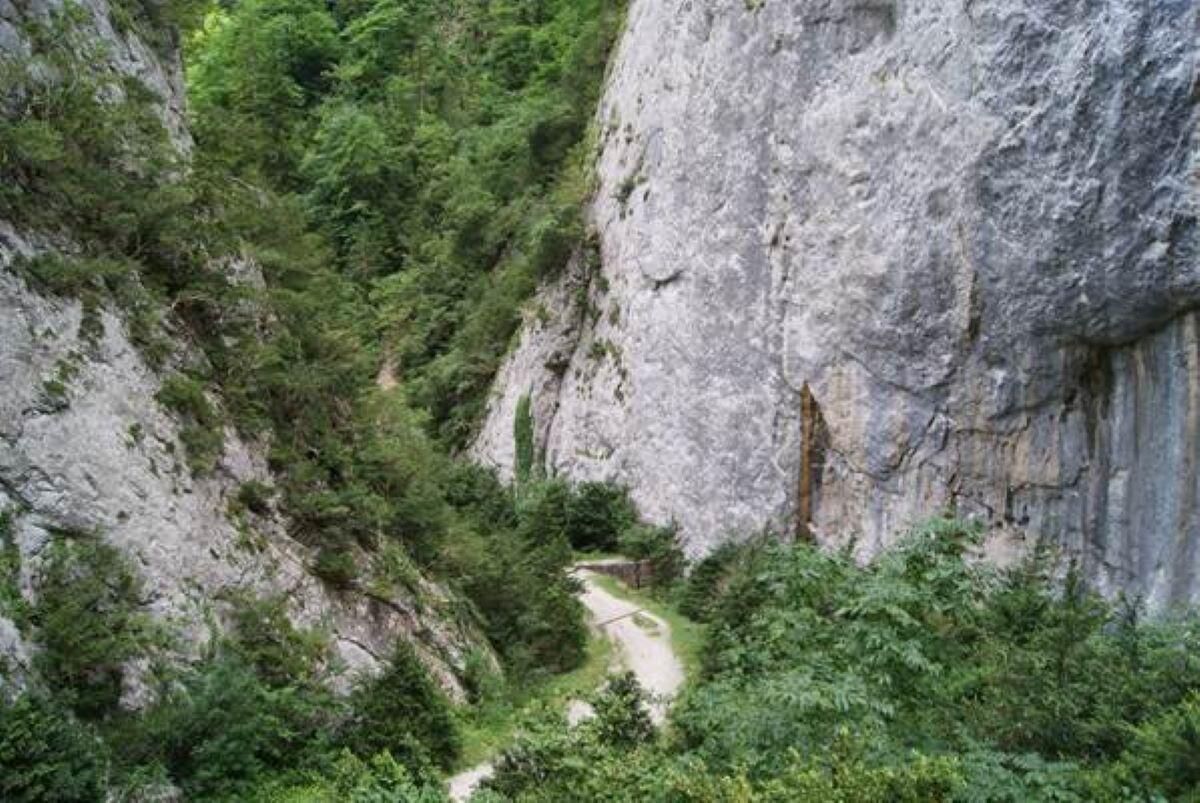
    2 - Take the narrower, steeper trail and walk 2.7 km through the Gorges until you reach the forest road.

    3 - Turn left toward Comus and follow the forest road for 2.9 km to reach the foot of the village. Along the way, you’ll pass a stone block topped with a cross, and shortly after, the Chemin de l’Ourza.
  • Departure
    Fougax-et-Barrineuf
  • Difference in height
    650 m
  • Plain text period
    All year round daily.
  • Environment
    • Forest location
  • Spoken languages
    • French
  • Documentation
    GPX / KML files allow you to export the trail of your hike to your GPS (or other navigation tool)
650 meters of difference in height
  • Maximum altitude : 1186 m
  • Minimum altitude : 615 m
  • Total positive elevation : 650 m
  • Total negative elevation : -96 m
  • Max positive elevation : 259 m
  • Min positive elevation : -28 m